The data utilized in this tool are provided by the International Argo Programme, a component of the Global Ocean
Observing System (GOOS). The Argo Programme, with contributions from various national programs, offers open
access to its data (http://www.argo.ucsd.edu, http://argo.jcommops.org).
Argo is a global network of almost 4,000 free-drifting profiling floats, deployed worldwide, monitoring the
temperature and salinity of the ocean's upper 2,000 meters. This network allows for the first-ever continuous
observation of key oceanographic parameters, with data rapidly relayed and made publicly accessible.
Since the first float launches in 2000, Argo has significantly advanced ocean monitoring. The network's growth
has been continuous, with the array expanding and evolving to provide comprehensive global coverage. While the
network is extensive, efforts continue to address coverage gaps in certain ocean areas. The original design of
the Argo array has evolved to overcome challenges in ice-prone and marginal sea zones, thanks to advancements in
two-way communication and ice-detection technology. The enhanced Argo array now aims to maintain around 4,000
floats, including in previously under-covered regions.

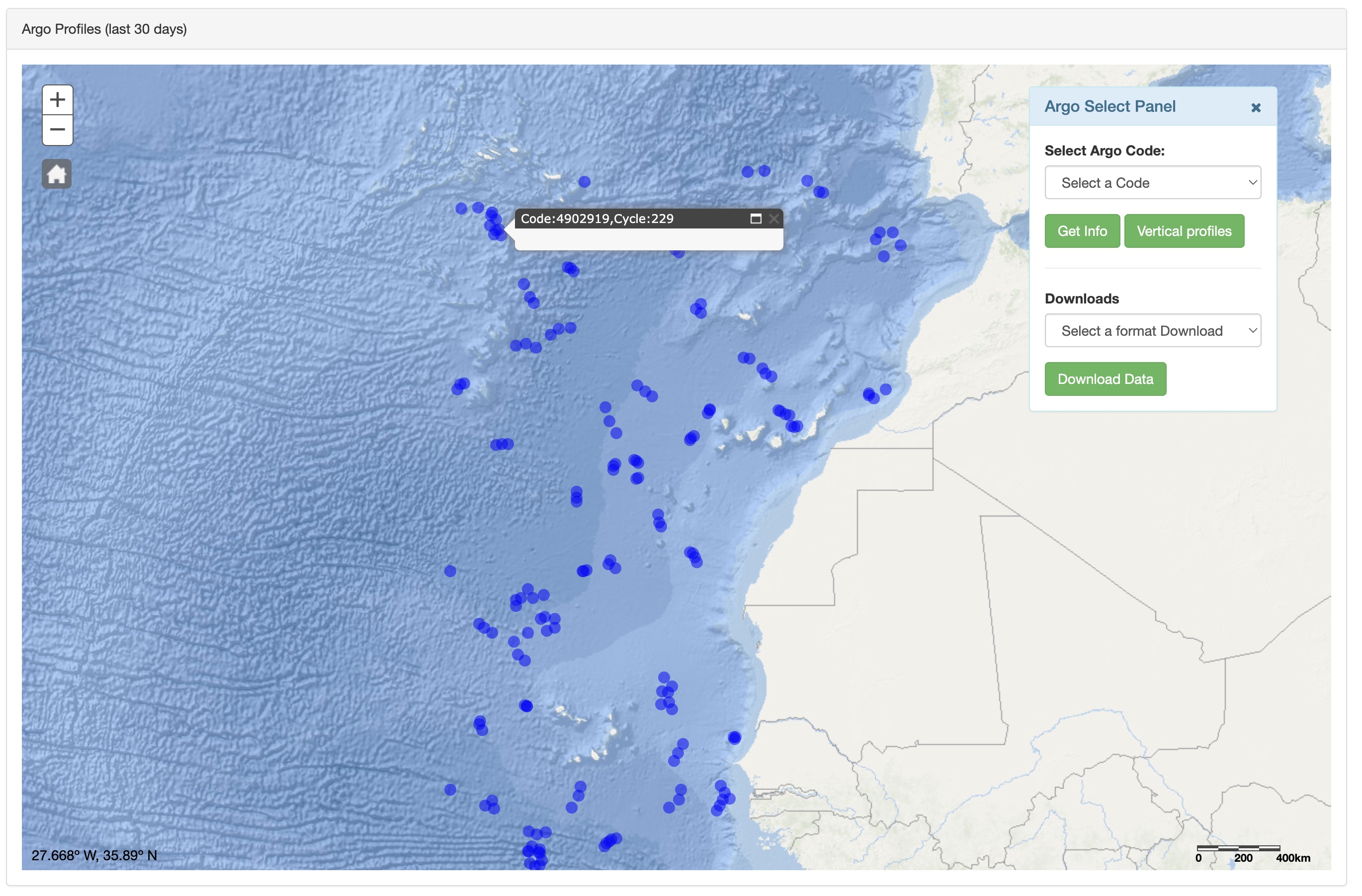
Figure: Positions of floats that have delivered data within the last 30 days
Argo's scope is expanding beyond its core mission. Initiatives include increasing bottom ocean coverage,
integrating bio-geochemical sensors, and enhancing spatial coverage in boundary currents and equatorial areas.
These enhancements are in various stages of development and implementation.
Argo emphasizes dual data streams: real-time for immediate access and delayed mode for quality-controlled data.
Approximately 90% of profiles are available within 24 hours through Global Data Assembly Centers (GDACs).
Delayed Mode Quality Control (DMQC) is applied to further refine data accuracy, with 65% of eligible profiles
undergoing this process.
Float reliability and longevity have progressively improved. Argo serves a diverse user community, including
academic institutions, government labs, and climate analysis and forecasting centers. The ongoing need for Argo
data ensures its indefinite operational status, with technological and methodological advancements anticipated.
The data of the tool is sourced through real-time API requests to the Euro-Argo Fleet Monitoring service. This
service is part of the Euro-Argo ERIC, a European research infrastructure consortium dedicated to the operation
and management of the Argo network in Europe. Euro-Argo's role is important in maintaining the European
contribution to the global Argo program, ensuring the continuous collection and availability of high-quality
data from the floats.
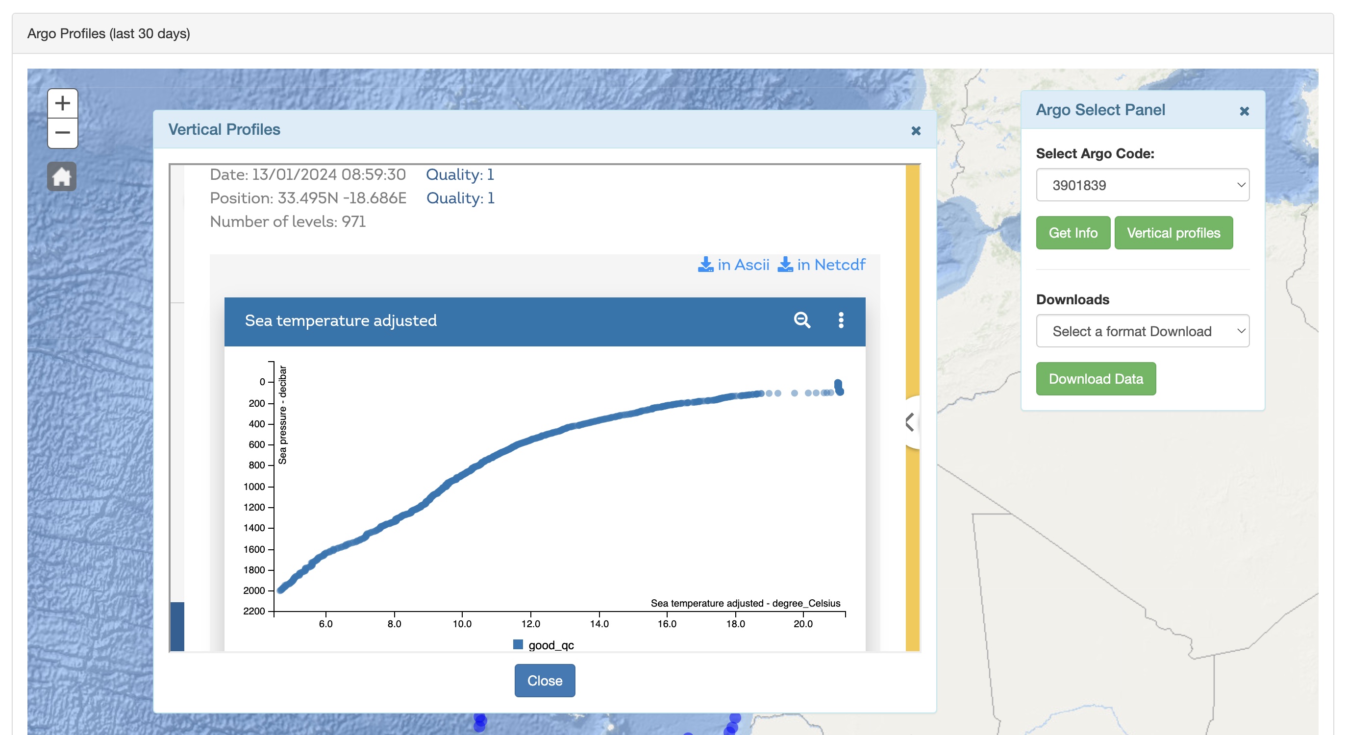
Graphical representations of temperature and salinity and data profiles for download are provided by Ifremer
(French Research Institute for Exploitation of the Sea), a leading institution in ocean science and technology.
Ifremer supports the Argo program, contributing significantly to the management, processing, and dissemination
of Argo data. The images and data available from Ifremer offer users insights into the oceanographic conditions
captured by the Argo floats.
Argo is a major contributor to the World Climate Research Programme's (WCRP) Climate Variability and Predictability (CLIVAR) project and the Global Ocean Data Assimilation Experiment (GODAE). The Argo array is part of the Global Climate
Observing System/Global Ocean Observing System (GCOS /GOOS).